Friday, January 31, 2020

What happened in Koo Wee Rup in 1920

This is a look back 100 years at what happened in Koo Wee Rup and surrounds in 1920.

Mickle Memories of Koo Wee Rup by David Mickle, is a chronological look at the history of Koo Wee Rup. David starts the 1920 entry with the following about hay stacks. David’s brother, Fred’s diary entry for January 1 recorded that our big hay shed was filled with close to 100 tons. We had to hire a stack builder as we couldn’t manage to build stacks. The leading stack builder, Jack Kelly, was a real hard case, made us drop the sheaves right where he wanted them. Good stacking is a sort of expanding circular procedure lapping the sheaves as you go. In five days we had two stacks with about fifty-five tons up. When Jack received his cheque on Friday or Saturday he rarely had much left Monday morning. He earned £1 a day, well above the rate for other hands. David also wrote that Fred says we killed twenty snakes during harvest.

David wrote that there was a navvies camp in Koo Wee Rup -  a navvie was a labourer employed to construct roads and railways -  and they were working on the new line that went from Koo Wee Rup to Strzelecki. Fred found 160 beer bottles near the camp. The going rate for the bottles was 6 pence a dozen, which amounted to eight shillings, which was good money as at the time they were getting only 2 shillings and six pence per day picking spuds.

In February, the Koo Wee Rup Sun had this report, with the headline Phone Facilities. It is a surprising oversight on the part of some business people of Koo Wee Rup and Cranbourne who still muddle on without installing a telephone, thus placing themselves and customers at great disadvantage and inconvenience….[they should]  keep abreast of the times and not live as in the days of ancient runners that the telephone service has pushed out of work. (Koo Wee Rup Sun February 19, 1920)


Feat of flying
The Herald March 19, 1920  http://nla.gov.au/nla.news-article242172019

In March, this interesting feat was reported Flight to land sale - a crowded three hours - Flying from Melbourne to Koo-wee-rup, a distance of nearly 50 miles, in 25 minutes, completing a land sale, attending races at Koo-wee-rup, and returning to Melbourne, in a little more than three hours, was the achievement yesterday afternoon of Mr A. F. Witham and Mr B. Kavanagh, of Messrs Witham, Woodman and Kavanagh, land salesmen. (The Herald March 19, 1920) David Mickle also wrote about this in his book - the flight took place on St Patrick’s Day, they flew at 96 miles per hour and landed in what was then a paddock opposite the Secondary College. The pilot, Captain King gave a demonstration for the excited crowd.


John Mickle's Lauriston Park subdivision sale advertisement
Koo Wee Rup Sun, April 1 1920

In the April, David’s uncle, John Mickle subdivided some of his Lauriston Park property. The subdivision started from the Rossiter Road/Station Street intersection, down towards what is now the Secondary College. In 1926 further subdivision took place with the creation of John, Alexander and Mickle Streets.

Also in April the Koo Wee Rup Sun raised this issue - It would be interesting to find out how much money is thrown away by the various Government Departments in the getting of reports.  In Koo Wee Rup we have had a large number of reports in connection with railway matters, while last week officials of the Police department went over the same old routine of several months ago in connection with the establishment of a permanent police station here. This repetition of reports…..is a testimony to money and labour being wasted. So, no change here 100 years later. (Koo Wee Rup Sun April 22, 1920)

1920 saw the opening of two local State Schools - Dalmore School was on August 6. The first teacher was Emilie Pitt. According to a report in the South Bourke & Mornington Journal, the school was on a splendid site, had a nice appearance inside and out and had excellent lighting and ventilation.   The other school was at Monomeith, which first occupied a room in a house. The actual school building was occupied in July 1924. It was a very short-lived school as it closed in May 1933. The Monomeith building was relocated to Tooradin North in 1935, where it was used until 1970. In 2005 it was relocated again, to the Fisherman's Cottage Museum Complex, on the Foreshore at Tooradin.


Photo of the train wreckage at Koo Wee Rup
Weekly Times August 21, 1920  http://nla.gov.au/nla.news-article222557562

On August 18, a tragic accident happened at the Rossiter Road railway crossing when a car collided with the express train from Nyora. Two State Rivers & Water Supply Commission men were killed, William Thomson and Allan Deal. The Coroner in his report had a verdict of misadventure. The evidence of the men from the Railways said it was a good level crossing, but evidence presented by the motor car driver, Jack Dalley, and the owner of the car, Andrew Colvin and others said it was a dangerous crossing.

Also in August the Koo Wee Rup Sun reported on the visit of another aeroplane to Koo Wee Rup, this was in conjunction with 2nd Peace Loan. The plane toured the country and people subscribed to the loan (i.e. lent the Government money and they received interest). The money was for the repatriation of the soldiers. The plane landed behind the Royal Hotel on Monday August 23 and appeals were made and in the four hours the plane was in the town the people of Koo Wee Rup signed up for £4,900. The plane had been at Lang Lang on the same day and it raised £1,850. As David Mickle wrote, aeroplanes were No.1 drawcards in those days.

This is a bit out of Koo Wee Rup, but in August 1920 James Lecky of Cardinia Park in Officer South sold their property. Cardinia Park, previously called Gin Gin Bean, had been in the Lecky family since 1846. Perhaps the decision to sell was prompted by the fact that James lost two sons in the First World War - James (the younger) died of wounds on November 14, 1918 and William was killed in action on September 1, 1918.


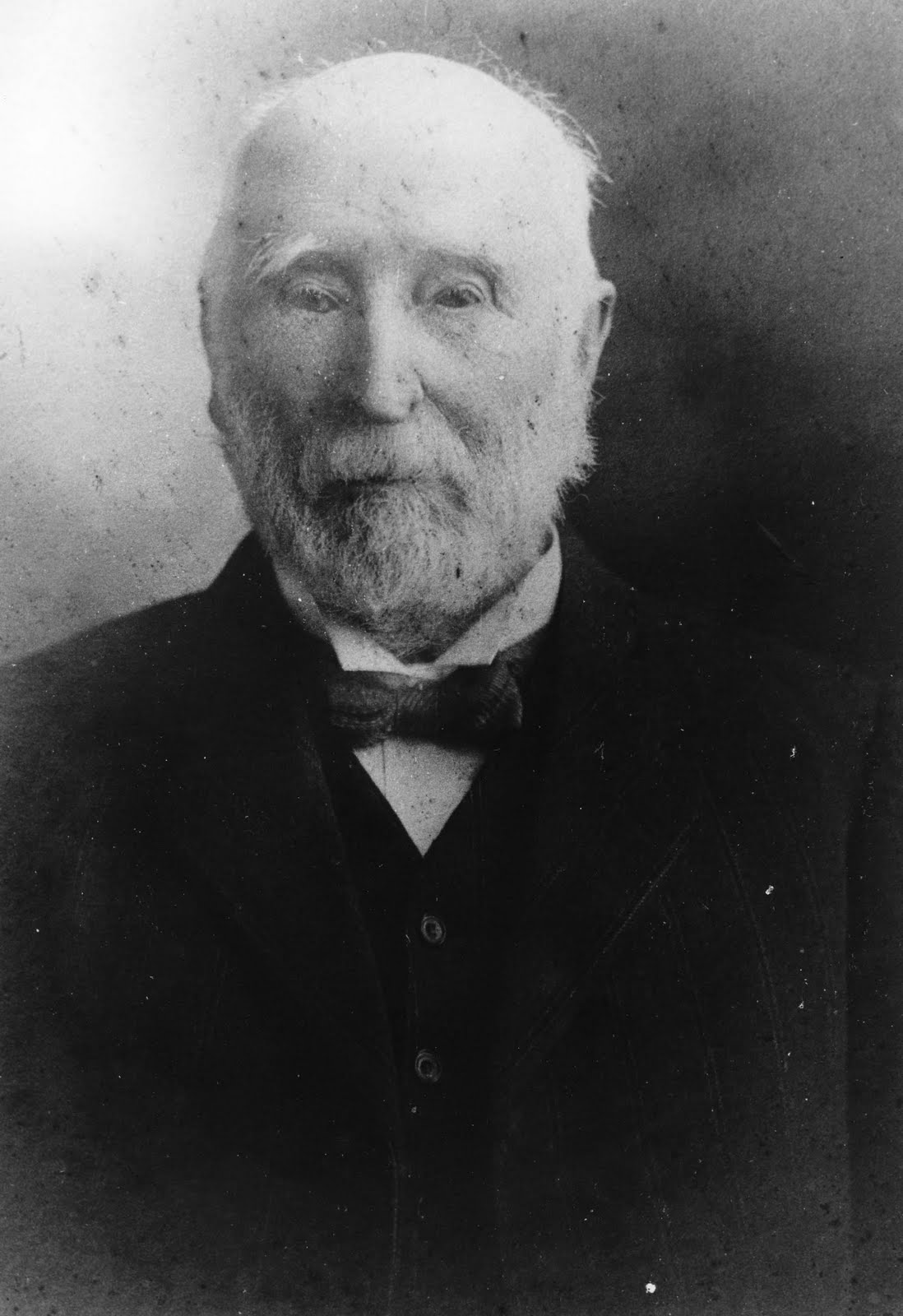
Christoper Moody (1833 - 1920)
Koo Wee Rup Swamp Historical Society photograph

We will finish this post with another pioneer, Christopher Moody, who passed away November 17, 1920. Moody purchased 1,686 acres of the Great Swamp run in 1875. He sub-divided land in the 1890s in the Koo Wee Rup township - what became Moody, Gardner, Henry and Salmon Streets. In 1902 he moved to Shepton in Rossiter Road.  He is also the source of the name of Moody’s Inlet. You can read more about Christopher Moody, here.

Saturday, January 18, 2020

Grandma's garden at Cora Lynn

I am rather fond of palm trees and there used to be a palm tree in the garden at Grandma's house on Murray Road, Cora Lynn. The property was called Evesham. Grandma was Eva Rouse (nee Weatherhead). Her garden was magnificent and the palm tree was out the back, near the water tank and next to a weeping cherry tree and near the holly bush. Growing next to the water tank was a tree dahlia, which as you would know, has a very short flowering season. Behind the palm was the vegetable garden and an orchard.  If we went around the house to the west side, Grandma had lots of dahlias; round the house to the front or the north and the the east side - were trees, blossom trees, magnolias, a feijoa, a camellias, various roses - bush and climbing; lilacs, a wisteria, bird of paradise, and then around the back on the back path to the back door there was a Cecile Brunner pink rose, fuscias, violets, hellebores, Chinese lantern trees, snowball trees, a mulberry tree. Plus various flowers everywhere - stocks, snap dragons etc.  The garden was her pride and joy.


My Dad (Frank Rouse), my aunty  Marion, and Grandma - off to church on a Sunday, around 1955 - and there's our palm tree in the back, behind the water tank.


Grandma in front of the tree dahlia, 1966 - and there's our palm tree on the right,  next to the elevated tank.


No palm tree in this photo - but this is Evesham and Grandma with two children and holding a baby, most likely my dad, who was born December 1934.


Evesham, 1958. No palm trees in any of the following photos, but here are some other photos of Grandma's garden. The fence was constructed by my Dad and my uncle, Jim Rouse. The top pipe was  a water pipe, which could have  a hose attached to the end and it had taps at various intervals to connect hoses.


Evesham, 1958


Evesham, 1958. This is the driveway, the little building on the right is the chook feed shed. The bricks on the left are for a 3 bay open-fronted shed that was being constructed.


Evesham, 1964

Matthew Bennett, farmer and M.L.A

Matthew Bennett was born January 20, 1862 at Carngham, near Ballarat, to Joseph and Elizabeth Ann (nee Temby) Bennett. The family later moved to Benjeroop where they farmed. As well as Matthew there were three other sons - Edward (died 1919 at Nathalia, aged 63); Richard (died 1900 at Kerang, aged 41) and Thomas (died 1914 at Kerang, aged 41) and a daughter, Emma (Mrs Chester Eagle, died 1943 at Barham). When Joseph died on March 24, 1906 he and Elizabeth were living at Kerang. Elizabeth died May 1, 1924 at Barham in New South Wales.

Matthew had a farm in his own right at Benjeroop and on October 31, 1889 he married Mary Simpson at the Baptist church at Benjeroop. This church had been moved in June from its original location to a more central location in the town protected on the north and west by the high timber growing along the river, and [where] there is also a nice little grove of young trees close by, which will be a very convenient shelter for horses and vehicles, both in hot and cold weather (Kerang Times May 8, 1888).  Mary was the daughter of Charles and Emma (nee Bond) Simpson. They were also farmers from Benjeroop. Matthew and Mary had four daughters whilst they were living in the Benjeroop / Murrabit region.

Around 1893, Matthew was elected as a Trustee of the Benjeroop and Murrabit Water Trust. In 1905 the family moved 400 kilometres south to Yannathan, on the recently drained Koo Wee Rup Swamp. A ‘send-off’ was held for the family on March 21 and attended by 150 locals. The Kerang New Times reported on the occasion – the room being decorated with evergreens, pampas grass, palm leaves, etc, and with the tables attractively laid out and laden with enticing comestibles from the substantial ham and turkey to the lighter trifle and jellies.  Many complimentary speeches were made about Matthew, as you would imagine – He was a gentleman who was appreciated by all and had carried out whatever public duties he had performed honestly and fairly.  He had original ideas of his own and endeavoured to give them effect and was not afraid to have the courage of his opinion….He was an up to date farmer, ready to adopt any new method which would improve the farming interests and had shown what could be done in the district by irrigation.

After the speeches Matthew was presented with a handsome gold Albert and locket and Mary was presented with a silver hot water kettle with spirit lamp attachment. A ‘gold Albert’ I have just found out is a watch chain. The evening finished with the National Anthem, followed by a dance which was kept up to an early hour.  (Kerang New Times March 24, 1905, see here)

The family moved to Crown Allotments 28 and 29, Parish of Koo Wee Rup East. The allotments  were 159 acres and 154 acres respectively - 313 acres in all. They were near Bayles on the north side of the Bayles-Modella road. When the Bennetts moved to the area it was called Yannathan, but the area was later known as Catani.  Both Bayles and Catani came into existence as they were stations on the Koo Wee Rup to Strzelecki Railway line which opened in June 1922 and the towns soon developed around the stations. Catani, was, of course, named for Carlo Catani, the Public Works Department engineer who worked on the Koo Wee Rup Swamp drainage scheme.  Initially Matthew was a dairy farmer, but he gave up dairying in September 1915, held a clearing sale and became a grazier.


Matthew Bennett's clearing sale.
Lang Lang Guardian September 29, 1915 http://nla.gov.au/nla.news-article119512940


The family took part in the life of the community, whilst they were at Yannathan.  Matthew was the president of the Yannathan New Year’s Day Sports Carnival; Mary was the vice-president of the Yannathan branch of the Lady Mayoress' Patriotic League and the whole family were involved with fund raising for ‘patriotic causes’ during the Great War. We will have a quick look at the lives of four Bennett daughters. The eldest daughter, Janey Gertrude was born in 1892. In 1917, she married Joseph Henry Carson, whose parents owned a property at Yannathan. Joseph had a property at Balldoran, north of Dubbo; Janey spent her married life in that region and died in 1984. The second daughter, Elsie Marjorie Elizabeth, was born in 1894. She married Abraham Alfred Patullo, of Lang Lang, in 1920 and they farmed some of the land that was owned by her parents. She died in 1980. The third daughter, Isabel Emma, was born in 1896, she never married and died in 1983. The fourth daughter, Josephine Eleanor was born in 1899 and married Jack Reeve Dowling, an Accountant from Melbourne, in 1936. She died in 1989.

Matthew Bennett was involved with the Victorian Farmers’ Union which became the Country Party in the late 1920s – he was on the Central Council at both State and Federal level and President of the local Yannathan branch, so it was no surprise that he would stand for election. On August 27, 1925 he was elected as a councillor to the Cranbourne Shire. His platform, as published in a letter in the Koo Wee Rup Sun of August 20, was primarily concerned with roads good roads are very essential in this Riding in particular, as it is one of intensive culture almost throughout. They facilitate production, which means wealth, cheapens transport, help to stop the drift to the city, brightens country life and very materially help primary producers and country townspeople to prosper. Mr Bennett was Shire President on two occasions and remained on the Council until his death, in 1951. He was the Shire President 1931/1932 and 1941/1942.    In 1953, his grandson Stewart Patullo was elected as  a Cranbourne Shire Councillor.


Matthew Bennett
Dandenong Journal September 17, 1931 http://nla.gov.au/nla.news-article201085220

On October 1, 1929 at a by-election, Mr Bennett was elected to the Legislative Assembly for the seat of West Gippsland, representing the Country Party.  He retired from Parliament after nearly 21 years on April 1, 1950. Apart from the fact that he was then well into his eighties, his health had been affected by illness and a serious car accident in January 1949. Matthew Bennett was a farmer and had country interests at heart and one of his achievements was the establishment of the Milk Board in December 1933, which regulated the dairy industry.

Matthew’s wife, Mary died on August 2, 1925. The death notice said that she died at her residence 16 Service Street, Hampton. She is buried at the Brighton Cemetery. It was just after her death that Matthew decided to stand for Council - I wonder if those two events were linked?  Of interest though is the fact that in 1925, Mary Bennett was not living at Catani or Yannathan. Even though Matthew Bennett maintained property in the area, he also did not live in the country. From 1926 his residential address in the Shire of Cranbourne Rate books was 631 Inkerman Road in Caulfield, so maybe the roads still weren’t good enough for them and country life was not ‘bright’ enough for them and they ‘drifted’ to the city.

However, he was still popular as he kept getting re-elected and there are various reports of ‘complimentary socials’ being held in various local towns.  In fact, in August 1944 at a function at the Catani Hall, Mr Bennett was presented with an illuminated address, and he was congratulated on having won such universal esteem and on having attended to his parliamentary duties in the interests of all, irrespective, of party. (Dandenong Journal August 2, 1944).

Matthew Bennett died on January 16, 1951 and he was buried with his wife Mary at Brighton Cemetery. His obituary in the Dandenong Journal of January 17, 1951 said he was affectionately known as “Mattie” throughout the length and breadth of Gippsland, was a wonderful character, who made friends everywhere, but never an enemy. Matthew Bennett Park in Drouin is named after him as is Bennett Road in Catani.

I have created  a list on Trove on newspaper articles on Matthew Bennett, you can access it here. All the articles referred to here are on this list.


Monday, December 23, 2019

Cora Lynn in flood

This postcard was  sent by my grandfather, Joseph Rouse, to his uncle Bob, Robert Rouse. Joe was born in November 1892 and he and his father, James, arrived at Cora Lynn in July 1903 (read about this here).  The post card shows Cora Lynn in flood, possibly the June 1911 flood. The building on the right is the E.S & A Bank. I believe it opened around the same time as the Cora Lynn Cheese factory, which was December 1910 or early January 1911.


This is what was written on the post card. It doesn't sound like Grandpa was much of  a correspondent.


Cora Lynn Thursday 8th 

Dear Uncle Bob,
Just a  few lines to ask how you are all getting on write and let me now (sic) as soon as you can and I will write again. Dan Tierney told me to write years ago but I have never done so. This card was taken in the time of the flood last year you can see Tierney's house the furthest away with the pine trees in front. I will close with love to all for  now. I remain your loving nephew, Joseph Rouse.

Wednesday, December 18, 2019

Koo Wee Rup - an acrostic

This is a potted history of Koo Wee Rup, using the name as the acrostic.

K is for Koo Wee Rup - the name of the town and the Swamp. Koo Wee Rup is Aboriginal for “blackfish swimming”. The railway station at Koo Wee Rup was named Yallock when it opened in 1890 and it was renamed Koo Wee Rup in 1892. There has always been a bit of an issue as to how you spell Koo Wee Rup. It could be Koo wee rup, Koo Wee Rup, Kooweerup, KooWeeRup, Koo-wee-rup or Koo-Wee-Rup.  On my Birth Certificate it has the town spelt as both Koo-Wee-Rup and Kooweerup and various documents from my time at the High School in the 1970s has the name spelt as Koo-wee-rup, Kooweerup and KooWeeRup, so even Government organizations were having a bet both ways. VicNames - the Register of Geographic Names lists it as Koo Wee Rup. You can access their website here https://maps.land.vic.gov.au/lassi/VicnamesUI.jsp  See also, here.

O is for Oil and Petrol, sold at garages. The first garage in Koo Wee Rup, was Mills and Davey, who were agents for Dodge Cars. They began advertising their up-to-date motor garage in the Koo Wee Rup Sun from January 1924.  As well as having the Dodge Agency, Mills and Davey were also Agents for Triumph and Harley Davidson Motor Cycles. The building is still there, it’s the yellow building in Station Street. Dusting’s garage (now the Vet surgery in Rossiter Road) was built around 1926 and owned by Robert Dusting from around 1930. In September 1932, Dusting announced in the Koo Wee Rup Sun that he had secured the Ford Dealership for Koo Wee Rup and Districts. Light’s garage was built for Thomas Burton and opened in February 1939. The Koo Wee Rup Sun described it as a new modern, commodious motor garage with up-to-date machinery and electric light.


Mills & Davey Garage at Koo Wee Rup
Koo Wee Rup Swamp Historical Society photograph

O is for Overseas Communication and by this we mean the Amalgamated Wireless (Australia) Ltd Wireless Experimentation Radio Station which was erected off Sims Lane in 1921. It operated until 1922. This Station confirmed that direct and efficient communication between Great Britain and Australia was feasible. Radio communications, at this time, were sent and received by a series of relays. Wireless signals sent from Britain had already been received directly in Australia as early as 1918, as European Stations could be heard at certain times in Australia. These transmissions are affected by weather and especially sun activity.  The experiments at Koo Wee Rup used a heterodyne type receiver, with six stages of radio frequency amplication and two stages of audio frequency amplication. The research showed that wireless signals could be received over long periods each day from New York, Rome, England, Paris and Germany and were consistent enough to prove that direct wireless communication was both practical and reliable between Australia and Britain. See also, here and here.


The A.W.A Radio Station at Koo Wee Rup

W is for Water - as early as 1918 there was agitation for a water supply scheme in Koo Wee Rup and this issue came up periodically with the Koo Wee Rup Progress Association, however it wasn’t until 1929 that the Koo Wee Rup Water Works Trust was formed. Later that year the State Rivers and Water Supply Commission (SRWSC) approved the plans for a water scheme and applications for tenders for the work were advertised in June. The tenders were for the construction of Head works, including an elevated reinforced concrete tank (the water tower that is still there) and settling basin - tender price was £4985.00 which included the construction of the water tower, the laying of pipes, the pumping machinery.  How did the Scheme work? Water was obtained from the Bunyip Canal (Main Drain) and was pumped into a concrete settling basin of 160,000 gallons (one gallon is about 4.5 litres) having passed through a filtration process. It was then pumped into a 90-foot (about 27 metres) tower which had an 83,000-gallon capacity. The water was then distributed around the town. See also, here.

E is for Education - there have been five primary schools called Koo Wee Rup and ironically the original Koo Wee Rup State School, No.2629, was actually called Yallock, until 1903 when it was changed to Koo Wee Rup. The Cora Lynn State School, No. 3502, was known as Koo Wee Rup Central when it opened in January 1907 and changed its named to Cora Lynn in September of that year. The Modella State School, No.3456, was known as Koo Wee Rup East when it opened in January 1904. The Koo Wee Rup North State School, No.3198, at Five Mile, was initially called Koo Wee Rup South when it opened in July 1894. Finally, the Iona State School, No. 3201, was originally known as Koo Wee Rup North.

E is for Eternal Rest - or Cemeteries. The Koo Wee Rup Swamp doesn’t have a cemetery, I presume because it was too wet and swampy, so residents of the Koo Wee Rup Swamp could be buried at Pakenham, Cranbourne, Lang Lang or Bunyip depending on what area of the Swamp they lived. The earliest cemetery was the Cranbourne Cemetery - the site for the Cemetery was reserved on December 11, 1857.   William and Annabella Lyall are both buried at Cranbourne - they were the owners of Harewood house on the South Gippsland Highway which they built from 1857. A report of the content of his will says that William Lyall ‘directs that his body be buried in the allotment set apart on his property as a private burying ground and that as little expense as possible be gone to in connection with his funeral’.  It doesn’t appear that his wishes were adhered to in the matter of the burial as he has a substantial grave at Cranbourne. Also buried at Cranbourne is Charles Rossiter, the source of the name Rossiter Road.  See also, here.

The site for the Pakenham Cemetery was reserved on February 13, 1865 although it is believed that the first burials actually took place in the 1850s.  The owner of the Royal Hotel at Koo Wee Rup, Denis McNamara, was buried at Pakenham after his death on July 27, 1925. Mr McNamara had started a business in Koo Wee Rup in 1891, then left the area and returned in 1904 when he purchased O’Riordans store and in 1915 built the Royal Hotel. His funeral was described as one of ‘the largest in the district, representative of every class and creed’.  The Bunyip Cemetery site was officially reserved on November 22, 1886. This cemetery was used by folk living on the eastern end of the Koo Wee Rup Swamp such as Cora Lynn and Iona. The first official burials did not take place until eight years after the Cemetery was officially gazetted with the first one in March 1894. Of the first 20 burials in the register, 19 were children. Lang Lang Cemetery site was reserved on December 5, 1887. Christopher Moody, the source of name Moody Street is buried at Lang Lang. In 1890, Mr Moody owned the site of the Koo Wee Rup township and sub-divided the land between Rossiter Road and the Main Drain and Denham’s Road and the Highway. Very little of the land was sold due to the 1890s depression. The sub-division set out Moody, Gardner (called Koo Wee Rup Street by Moody), Henry (called Christopher Street by Moody) and Salmon Streets.

The Bunyip River from a 1940s postcard.

R is for River - the Bunyip River or the main drain of the Koo Wee Rup Swamp. It was William Thwaites of the Public Works Department who came up with the scheme to drain the Koo Wee Rup Swamp by the creation of the main drain from south of Bunyip where the Bunyip River entered the Swamp to Western Port Bay. Work started in 1889 and finished in 1893.  Over the years, many more drains were dug or enlarged. The maintenance schedule from the SR & WSC, that we have at the Historical Society, lists 136 different drains, with a total length 465 km.

U is for Unions - the union between a man and a woman in Holy Matrimony commonly known as weddings. I don’t know when the first marriage took place in the town, it was probably officiated by a visiting minister in a private house. The first church building in the town was the Presbyterian Church where the first service was held in 1896 and the first Catholic Church was built in 1902. The Anglican Church was built in 1917 and the Methodist Church (now Uniting) was moved from Yallock to Rossiter Road in 1932. Reports of engagement parties, kitchen teas and weddings were the mainstays of local papers for decades and photographs began appearing in the 1960s in the Koo Wee Rup Sun. Early reports listed all the gifts received and they all had descriptions of the dress, bridesmaid’s dresses, the ‘going away’ outfit and what the mother of the bride and mother of the groom wore.

P is for Potatoes which have been grown on the Koo Wee Rup Swamp, since it was drained.  The western end of the Koo Wee Rup Swamp was said to have produced 3000 tons of potatoes in 1894, just one year after the blocks were allocated to settlers. By the 1920s, the area was producing one quarter of Victorian potatoes. Potatoes have also been instrumental in the establishment of local Railway lines. It was recognized from the start that potato traffic would be a mainstay of the Strzelecki line from Koo Wee Rup to Bayles, Catani and beyond which opened in 1922.  The importance of the potato was celebrated by the Annual Potato Festival which took place from 1973 to 2000. It was a major fundraiser for the Koo Wee Rup Hospital.


Frank Rouse (My Dad)  grew potatoes on the Koo Wee Rup Swamp at Cora Lynn for 57 years, until his retirement from the potato business in 2007. This photograph was taken in 1968 for a fertiliser company.


Saturday, November 23, 2019

Record consignment of cattle brought to Monomeith, April 1967

These great photos (the colour ones), courtesy of Neville Clark, are of Hugh Bourke, off-loading cattle at Monomeith Railway Station. They had been sent from Casino in New South Wales. There was an article in the Koo Wee Rup Sun of April 26, 1967, about the shipment.  Neville thought it was 760 head of cattle, the paper quoted 731, which ever is correct, that is a lot of cattle.  I have transcribed the Koo Wee Rup Sun story.


Koo Wee Rup Sun April 26, 1967, page 1

From page 1 - Record consignment of cattle brought to Monomeith
Cattle made the news this week when a record shipment of731 head arrived at Monomeith in a  53 car special train. The cattle had been bought in Queensland by Mr Hugh Bourke and their arrival created somewhat of a flutter in the local community.  See story inside.

Koo Wee Rup Sun April 26, 1967, page 3

From page 3 - Off-loading 731 cattle at Monomeith Station
A record consignment of 731 head of cattle, transported on a special train of 53 stock cars arrived at Monomeith on Monday afternoon. The cattle had been purchased two weeks ago by local graziers, Mr Hugh Bourke and his son, Mr David Bourke at sales in southern Queensland.  The cattle travelled over 1000 miles by the time they had arrived at Monomeith.
It was by far the biggest consignment of cattle to come to this area and was also the biggest one train load.
The cattle were loaded at Casino. They had to travel upwards of 20 miles on foot before undertaking the long rail trip to Monomeith.
It was certainly a memorable sight to see the big diesel pull into the Monomeith station hauling 53 trucks. A large number of people were on the station to see the operation completed.
An inspection of the cattle, mainly Herefords, revealed that they were in remarkedly good condition. 
The cattle were unloaded in three lots, the same as they had been purchased. Each lot was driven up to the Bourke property to begin the term of fattening for the Melbourne market.
Mr Hugh Bourke says the operation of buying cattle in 1967 was quite a business and involved quite a deal of air travel. On this buying trip he had been accompanied by his son David and Mr Stan Teague from Younghusband & Co. Mr Teague inspected all the cattle prior to the sale.
Mr Bourke said that he purchased the first lot of over 300 cattle and left to attend another sale by air. The remaining four hundred odd head were purchased by David.
On the trip the cattle were accompanied by big Bill McCormick and his nephew Mr Peter McCormick from McCormick and Co. Livestock agents from Casino.
Mr Bill McCormick had the touch of the big outback about him, but he was the essence of efficiency and had complete control of the operation.
The Bourke family at Monomeith have landed two prior shipments of cattle from the north at their property. The first was of over 300 head and second one was over 500 head.


The cattle at Monomeith Railway Station April 1967.
Photo courtesy of Neville Clark


The 'big diesel' Monomeith Railway Station April 1967.
Photo courtesy of Neville Clark


The 53 stock cars - Monomeith Railway Station April 1967.
Photo courtesy of Neville Clark


Monomeith Station, April 1967.
Photo courtesy of Neville Clark

Monday, November 11, 2019

A canal from the Yarra River to the Latrobe River via the Koo Wee Rup Swamp

On July 20, 1867 The Age published this letter to the Editor, from J. Wood Beilby of Dandenong. Mr Beilby suggested the construction of a 140 mile long canal from Yarra River to the Latrobe River, via the Koo Wee Rup Swamp and the Bunyip River flats. The canal would be 30 feet wide and four to five feet deep and suitable for stern-paddle wheel steam tugs and barges. The canal was never built.

John Wood Beilby arrived in the Port Phillip District in 1841 and ran stock on the Gardiner's Creek, he then worked on various runs from Flowerdale to the Glenelg River and was an early explorer of the Mallee region. In 1850 he was associated with the Wedge Brother at Corhanwarrabul on the Dandenong Creek and and took over the Tirhatuan run from the Reverend James Clow (1790-1861), also on the Dandenong Creek. He later spent much time contributing to the Press and he died in 1902, aged 83. The Australasian of June 6, 1936, published a short biography of him and other Pastoral Pioneers, in serial form, you can read his story, here.

CANAL VERSUS RAILWAY COMMUNICATION WITH GIPPS LAND.
TO THE EDITOR OF THE AGE.
Sir, — I beg space to draw the attention of the Government and of all interested in the speedy opening up of a ready and economical mode of communication between Melbourne and the Gipps Land Lakes, by means of a canal suited for stern-paddlewheel steam tugs and barges. The route from the Yarra via the Tanneries or valley of Gardiner's Creek, Leman's Swamp, the Brighton Reedy Swamp, with fall to the edge of Carrum Swamp; thence the Teatree Swamp, through Berwick to the Koo-wee-rup Swamp; thence the Bunyip river flats, and across to the Moe Swamp margin, and thence by the Latrobe River to the Lakes, is throughout, with short exceptional localities, through a low-lying country, which would be immensely reproductive if drained. Much of the land is in the hands of the Crown, and if a liberal grant were made to a canal company, and debentures secured upon it, the undertaking would secure much of the capital required. The work would be of immense value to agriculturists and road boards in the districts intersected, in furnishing an outlet for draining operations, and, would yield an immense return to Government in the shape of reclaimed lands available for agricultural occupation, and by facilities for location upon rich lands now shut out from population by want of means of communication. Moreover, cheap freight or carriage, and facilities for landing goods anywhere along the route traversed, would tend more to development of local enterprise than rapid railway transit, to such stations as would be appointed as such on a line of railway. There are an infinity of products, available for increasing city trade and the general commerce of the colony, besides agricultural produce. Timber, bark and gums of various kinds; granite as varied in color and beautiful as any imported for our public buildings; clay suitable for pottery, or brick or tile, and drain pipe manufacture; coal too, and hosts of other mineral products would teem in from every direction. The expense of a canal, thirty feet wide by four or five feet deep, with all locks, fences, canal boats, bridges, &c., has been estimated on the confident authority of a canal engineer to cost not more than £3000 per mile. The distance from the Yarra or Melbourne to a navigable part of the Latrobe river would be under 140 miles. We have but little material en route harder than blue clay to excavate. We require no imported materials (or scarcely any) and the work throughout would enlist the favorable interest of the neighboring population, who would largely avail themselves of, and by increased production would reciprocate to the proprietors the benefits derivable from water carriage, accessible without necessary stations, at their very doors. The flow of water from the creeks and rivers intercepted in the course traversed would amply supply waste by evaporation and locks by the intervention of equivalent precautions. The colony would go ahead on its own resources without further increase of our national debt ; and room, and a suitable sphere of operations would be provided amidst rich arable lands rendered thus accessible and valuable for location of small capitalist immigrants, to whom a wise policy would offer special inducements to resort to our shores. — 
Yours obediently.
Dandenong. J.WOOD BEILBY.
The Age July 20, 1867, see it on Trove, here.