These are photographs John and I took of the Eleven Mile Bridge over the Main Drain at Cora Lynn / Vervale over the Main Drain. The bridge was replaced October - December 2015. The cost of the new bridge was $700,000, half funded by the Council and half by the Federal Department of Infrastructure and Development. I have written about the history of the Eleven Mile bridge,
here.
October 24, 2015 - Old bridge, from Main Drain Road, looking north.
October 24, 2015 - Old bridge, from Main Drain Road, looking north.
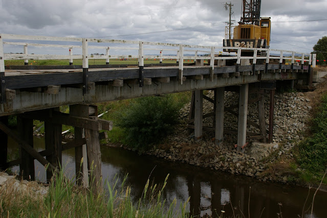
October 24, 2015 - Old bridge, from Bunyip River Road, looking south.
October 24, 2015 - Old bridge, from Bunyip River Road, looking south.

October 24, 2015 - Approach to old bridge from Main Drain Road (or south side)
October 24, 2015 - Approach to old bridge from Bunyip River Road (or north side)
November 14, 2015 - from Main Drain Road (or south side)
November 14, 2015 - from Main Drain Road (or south side), looking north west.
November 14, 2015 - from Main Drain Road (or south side), looking north east.
November 14, 2015 - from Main Drain Road (or south side)
November 14, 2015 - from Main Drain Road (or south side)
November 14, 2015 - from Main Drain Road (or south side)
November 14, 2015 - from Main Drain Road (or south side)
November 14, 2015 - from Main Drain Road (or south side), looking east.
November 14, 2015 - from Main Drain Road (or south side)
November 18, 2015 - from Main Drain Road (or south side)
November 18, 2015 - from Main Drain Road (or south side), looking north east.
November 18, 2015 - from Main Drain Road (or south side), looking north west.
November 18, 2015 - from Main Drain Road (or south side), looking north east.
November 18, 2015
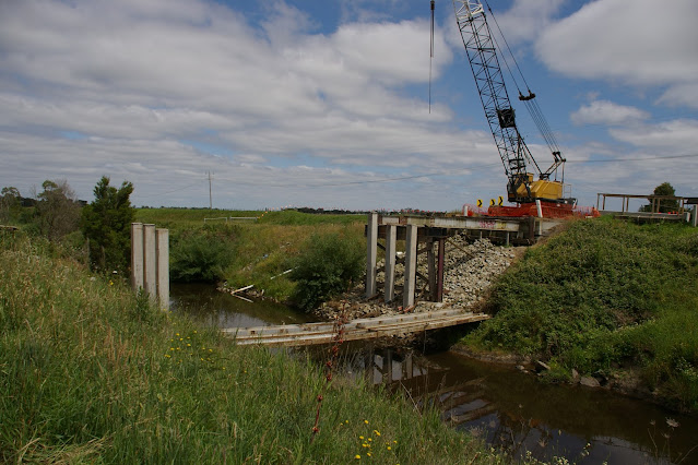
November 22, 2015 - from Main Drain Road (or south side)
November 22, 2015 - from Main Drain Road (or south side), looking north west.
November 22, 2015 - from Main Drain Road (or south side), looking north west
November 22, 2015 - from Main Drain Road (or south side)
November 22, 2015 - from Main Drain Road (or south side)
November 22, 2015 - from Main Drain Road (or south side)
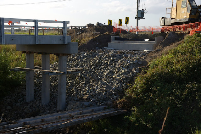
November 28, 2015 - from Main Drain Road (or south side)
November 28, 2015 - from Main Drain Road (or south side), looking north east.
November 28, 2015 - from Main Drain Road (or south side), looking north west.
December 1, 2015 - from Main Drain Road (or south side)
December 1, 2015 - from Main Drain Road (or south side), looking east.
December 1, 2015 - from Main Drain Road (or south side), looking north down the Eleven Mile Road.
December 1, 2015 - from Main Drain Road (or south side), looking north west.
December 2, 2015 - from Main Drain Road (or south side), looking north east.
December 2, 2015 - from Main Drain Road (or south side), looking north east.
December 2, 2015 - from Main Drain Road (or south side), looking north west.
December 2, 2015 - from Main Drain Road (or south side)
December 2, 2015 - from Main Drain Road (or south side), looking north
December 2, 2015 - from Main Drain Road (or south side), looking north east.
December 2, 2015
December 5, 2015 - looking north
December 5, 2015 - looking south.
December 5, 2015 - looking east down the Main Drain.
December 5, 2015 - looking north east.
December 5, 2015 - looking north west.
December 5, 2015 - from Main Drain Road (or south side), looking north west
December 5, 2015 - from Main Drain Road (or south side)looking north west.
December 5, 2015 - from Main Drain Road (or south side), looking north east.
December 5, 2015 - from Main Drain Road (or south side), looking north.
December 5, 2015 - from Main Drain Road (or south side), looking north.
December 5, 2015 - from Main Drain Road (or south side), looking north.
December 5, 2015 - from Main Drain Road (or south side), looking north.
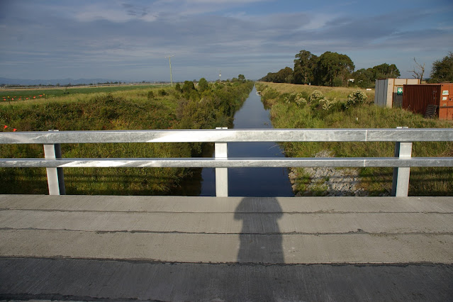
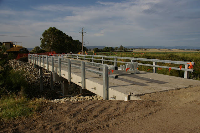
December 15, 2015 - finished - from Main Drain Road (or south side), looking north.
December 15, 2015 - finished - from Main Drain Road (or south side), looking north west.
December 15, 2015 - finished - from Main Drain Road (or south side), looking east.