Wednesday, March 16, 2022

Join us in a trip around Koo Wee Rup

Join us in a trip around Koo Wee Rup. These are part of  a little souvenir booklet of fold-out images of Koo Wee Rup, produced most likely in the late 1940s or early 1950s. The photos are reproduced here in the same order which they are in the original booklet.


Cover of the souvenir booklet

St John the Baptist Catholic School, opened in 1936.


Station Street, looking towards the Royal Hotel, which is the double storey building in the background. The E.S & A Bank was erected in 1906 and extended in 1919.


The Mills buildings (where the Radio shop is) were built about 1925.


 The Main Drain or the Bunyip River, at Koo Wee Rup.


 Rossiter Road. Scott's guest house was opened in 1934, the Alcove cafe next door was opened in 1933. The fire station is on the right - the Fire Brigade was established in November 1943 and a temporary fire station operated until the permanent building opened in 1947.


The Primary School at Koo Wee Rup. The original school was opened in 1884; it moved to this Rossiter Road location in 1910. This building was built in 1915 and burnt down in 1950. The Primary School relocated to Moody Street in 1960. The High School is now on this site.


Rossiter Road, taken from the railway crossing.


 St George's Church of England. It opened in 1917, and due to declining numbers the last service at the Church was held in 2012.

Thursday, March 3, 2022

Loading potatoes at Koo Wee Rup Railway Station

These are photos from the Koo Wee Rup Swamp Historical Society loading potatoes at the Koo Wee Rup Railway station. I believe they are from the 1950s (or maybe 1940s)


Koo Wee Rup Railway Station
Image: Koo Wee Rup Swamp Historical Society

Loading potatoes at the Koo Wee Rup Railway Station. These (above and below) are the same scene, different view. They are back to the good old days of manual labour when men and boys could lift a bag of potatoes, which weighed 150 lbs or 68 kg,  onto the back of a truck without a second thought. My father, Frank Rouse, and my uncle, Jim Rouse, grew potatoes at Cora Lynn  from 1950 - from when Dad was 16 and Jim was 18. Allegedly Jim could lift two bags of potatoes at a time - one in each hand. It may be a family story, but like many farm boys they were working for money on neighbouring farms from when they were about 13 and then milking the cows at home after that, so they were very strong.


Koo Wee Rup Railway Station
Image: Koo Wee Rup Swamp Historical Society

Trucks in Station Street outside the Koo Wee Rup Railway Station
Image: Koo Wee Rup Swamp Historical Society

This is the line-up of trucks, in Station Street in Koo Wee Rup, waiting to go into the loading yard. The double storey building on the left is the Royal Hotel, built in 1915. Potatoes have been grown on the Koo Wee Rup Swamp since 1893, when the land was settled after the drainage of the Swamp by the digging of the Main Drain. 

The Koo Wee Rup Railway Station was opened in August 1889,as part of the Great Southern Line. I have written about this railway line, here. Koo Wee Rup became a Railway Junction with the construction of the McDonalds Track Railway, or Koo Wee Rup to Strezlecki Railway line. This line opened in June 1922 and was completely closed by February 1959. I have written about this railway line, here.

Wednesday, March 2, 2022

Replacing the Eleven Mile Bridge - October to December 2015

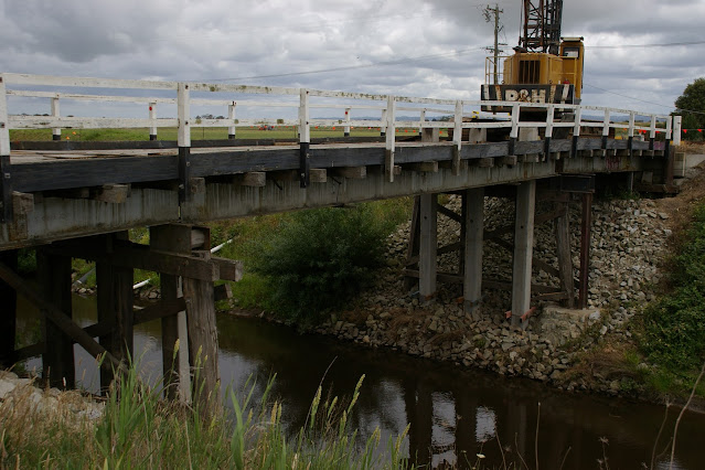
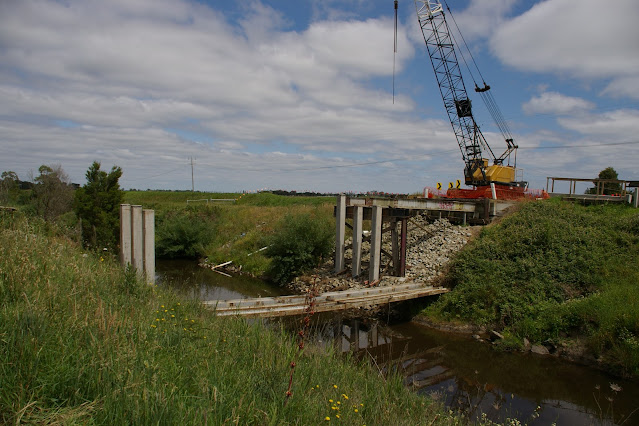
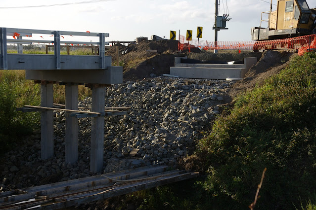
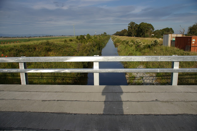
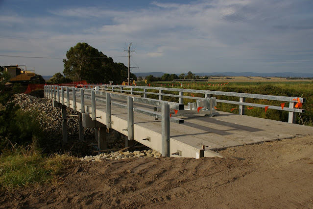
These are photographs John and I took  of the Eleven Mile Bridge  over the Main Drain at Cora Lynn / Vervale over the Main Drain. The bridge was replaced October  - December 2015. The cost of the new bridge was $700,000, half funded by the Council and half by the Federal Department of Infrastructure and Development.  I have written about the history of the Eleven Mile bridge, here.


October 24, 2015 -  Old bridge, from Main Drain Road, looking north.


October 24, 2015 - Old bridge, from Main Drain Road, looking north.


October 24, 2015 -  Old bridge, from Bunyip River Road, looking south.

October 24, 2015 - Old bridge, from Bunyip River Road, looking south.

October 24, 2015 - Approach to old bridge from Main Drain Road (or south side)


October 24, 2015 - Approach to old bridge from Bunyip River  Road (or north side) 


November 14, 2015 - from Main Drain Road (or south side)


November 14, 2015 - from Main Drain Road (or south side), looking north west.


November 14, 2015 - from Main Drain Road (or south side),  looking north east.


November 14, 2015 - from Main Drain Road (or south side)


November 14, 2015 - from Main Drain Road (or south side)


November 14, 2015 - from Main Drain Road (or south side)


November 14, 2015 - from Main Drain Road (or south side)


November 14, 2015 - from Main Drain Road (or south side), looking east.


November 14, 2015 - from Main Drain Road (or south side)


November 18, 2015 - from Main Drain Road (or south side)


November 18, 2015 - from Main Drain Road (or south side), looking north east.


November 18, 2015 - from Main Drain Road (or south side), looking north west.


November 18, 2015 -  from Main Drain Road (or south side), looking north east.


November 18, 2015


November 22, 2015 - from Main Drain Road (or south side)

November 22, 2015 - from Main Drain Road (or south side), looking north west.


November 22, 2015 - from Main Drain Road (or south side), looking north west


November 22, 2015 - from Main Drain Road (or south side)


November 22, 2015 - from Main Drain Road (or south side)


November 22, 2015 - from Main Drain Road (or south side)


November 28, 2015 - from Main Drain Road (or south side)


November 28, 2015 - from Main Drain Road (or south side), looking north east.


November 28, 2015 - from Main Drain Road (or south side), looking north west.


December 1, 2015 - from Main Drain Road (or south side)


December 1, 2015 - from Main Drain Road (or south side), looking east.


December 1, 2015 - from Main Drain Road (or south side), looking north down the Eleven Mile Road.


December 1, 2015 - from Main Drain Road (or south side), looking north west.


December 2, 2015 - from Main Drain Road (or south side), looking north east.


December 2, 2015 - from Main Drain Road (or south side), looking north east.


December 2, 2015 - from Main Drain Road (or south side), looking north west.


December 2, 2015 - from Main Drain Road (or south side)


December 2, 2015 - from Main Drain Road (or south side), looking north


December 2, 2015 - from Main Drain Road (or south side), looking north east.


December 2, 2015


December 5, 2015 - looking north


December 5, 2015 - looking south.


December 5, 2015 - looking east down the Main Drain.


December 5, 2015 - looking north east.


December 5, 2015 - looking north west.


December 5, 2015 - from Main Drain Road (or south side), looking north west


December 5, 2015 - from Main Drain Road (or south side)looking north west.


December 5, 2015 - from Main Drain Road (or south side), looking north east.


December 5, 2015 - from Main Drain Road (or south side), looking north.


December 5, 2015 - from Main Drain Road (or south side), looking north.


December 5, 2015 - from Main Drain Road (or south side), looking north.


December 5, 2015 - from Main Drain Road (or south side), looking north.


December 15, 2015 - finished - from Main Drain Road (or south side), looking north.


December 15, 2015 - finished - from Main Drain Road (or south side), looking north west.


December 15, 2015 - finished - from Main Drain Road (or south side), looking east.